As I checked out a few of the bass and fishing related blogs the other day I spotted a link on the excellent Labrax Squad blog. This led me to a free set of electronic charts which has already led me to new discoveries.
http://labraxsquad.tumblr.com/post/59276744182/navionics-free-webapp
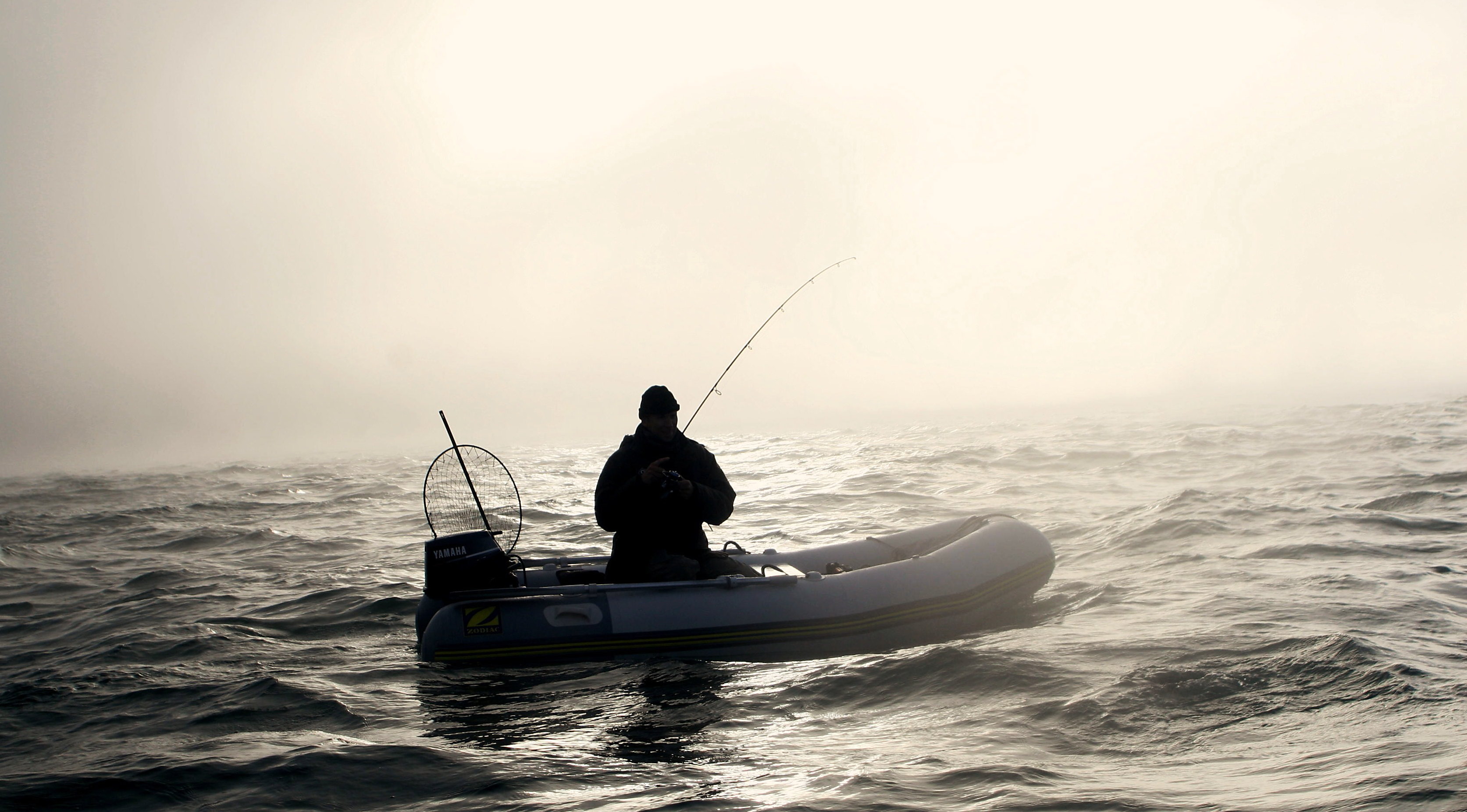
In the week since it came to my attention I have already searched the sea bed of all the areas already of the UK and Ireland familiar to me through my shore or small boat fishing. Not only is the information free it is more detailed than the paper Admiralty charts that tend to cover large scale areas. It hasn’t taken long for my new knowledge to prove its worth, as when fishing on the Devon coast the other day the fishing was dead in all my normal likely areas. There were no signs of bass or baitfish and the gulls sat looking disinterested on the shore. So remembering a small plateau of reef about the size of 2 tennis courts a few hundred meters off the shore identified using the Navionics chart, I sped over to it in my little Zodiac. Third cast produced the only bass of the whole session (followed by a series of wrasse between 3 and 41/2 pounds.) Had it not been for the new information the day would have been a blank rather than one notable for a 6 pound bass, and a new mark to explore.
This new resource brought to mind an aid to finding marks in Ireland I used to use, but had more recently pretty much forgotten about. It was one I first heard about from my bass fishing companion Al Hughes, who devoted a heroic amount of time to bass fishing research during the evenings he spent holed up in hotel rooms when away on a business. It is however a resource I have not seen mentioned by others despite its seeming usefulness to those who fish in Ireland, so it is time to spread the love.
http://www.coastalhelicopterview.ie/imf5104/imf.jsp?site=Helicopter
Click on to the map to select an area of the coast and suddenly you can indulge yourself in low level flight around Irish shore line, as successive images (usefully taken around low water) pass beneath you. See something interesting and just pause or rewind. For anglers like me who live away from the shore, and are unable to reconnaissance the ground first-hand, this ‘choughs eye’ view is yet another resource to help pin point new places to explore before you visit. I have to confess though it is more than a mere aid to finding new marks, it also provides yet another excuse to waste time dreaming about bass fishing when unable to physically get to the coast (apparently not something I need any further encouragement to do I am told).
One interesting observation from studying the numerous aerial images over the years is I have only spotted a single group of anglers along the whole of the Wexford, Waterford and Cork coasts. Something that either indicates the other anglers were paranoid enough about their marks to have dived behind rocks, or more likely there was a lot less fishing pressure on this coastline almost a decade ago.
So if this site proves useful, enjoy your flight. And should you know of a similar resource for the UK (other than Google Earth which lacks sufficient detail and always seems to have images taken at high water) do let me know, as I am always open to new places where I can “waste” my time planning and dreaming of bass fishing.
Words & pictures: Matt Spence